Moon set, looking west, into a hill.
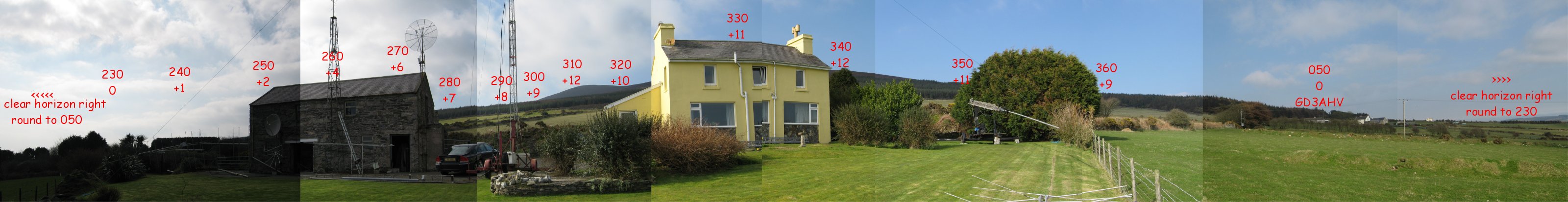
The JPG file is quite large, why not 'right click' and 'save as' then look at it in any file viewer you may have, such as paint shop pro, or, windows picture viewer for example. You can see indication of azimuth and elevation marked in red, the top figure is azimuth, the bottom would be required elevation to get over the ground in that direction. For example, the hill in front of the 6M11JKV yagi is at 305 degrees, but I'd loose moon at +12 degrees of elevation. The angles of azimuth may look a little odd in spacing, but that due to how i took the photos and moved around the garden to get the right shot. It's also why the house looks like it's split in two.
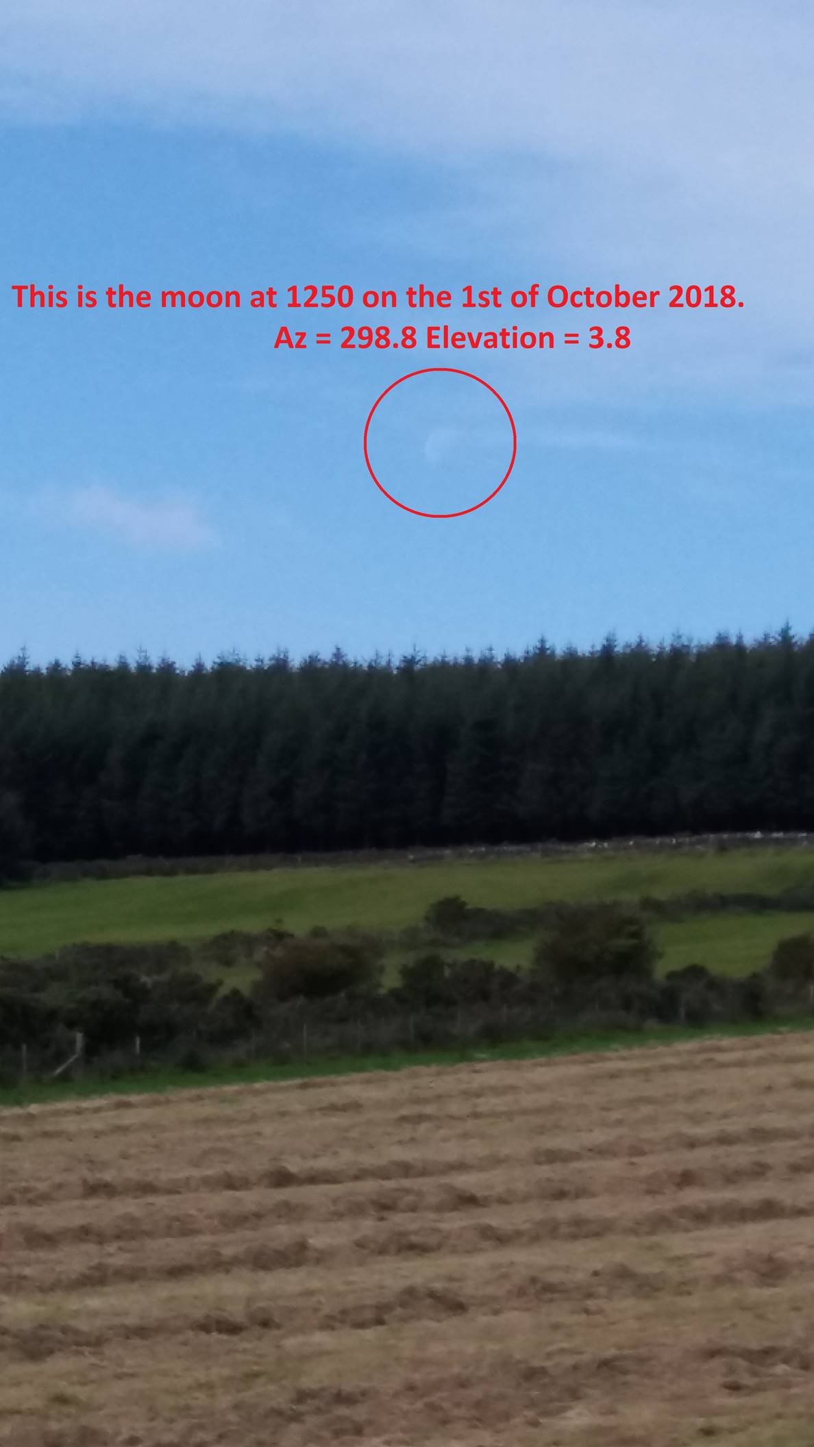
I took this picture above as an estimated guide for me. It turned out that I was ‘out’ by a few degrees. Below is a photo I took in October 2018, as you can see, it doesn’t quite ‘fit in’ with my estimates.
The location at IO74QD is about a mile down from the top of the hill and the grounds runs from this site right down to the coast, that's about 4 miles away.
The view here is looking right at the peak of the hill, at 300 degrees, if you turn through 180 degrees you'd be looking at 120 degrees, and that is straight in to Europe. That's why this is an excellent site for VHF contests, it also gives quality ground gain in the direction.